blah blah blah
Rattlesnake Mountain
Length: 2.5 miles out-and-back with loopDifficulty (click for info): Easy
Elevation Gain: 1000 feet (+0 feet on return)
Rating (click for info): 7/10
Elevation: 1604'
Prominence: 137'
Driving Directions:
Trailhead and parking area are on Buffalo Road in Rumney, NH. From the circle at the junction of Rts. 25 and 3A, follow Rt. 25 northwest 3.3 miles to the flashing light and turn right onto Main Street into the center of Rumney. Go 0.7 miles across the bridge and take a left onto Buffalo Road. The parking lot will be on the right after 2.5 miles. Do not confuse it with the rock climbing lots well before. The hiking trailhead is located right before the transfer station. It is a very limited, rough dirt lot on an uphill slope. Just before it on the same side is an open space to park near a monument where a connecting trail will take you to the main trail. If both of these are already occupied, you will have to find a place to park on the side of the road, which is not easy as much of the area is no parking allowed. Click here for a Google map.
About the Hike:
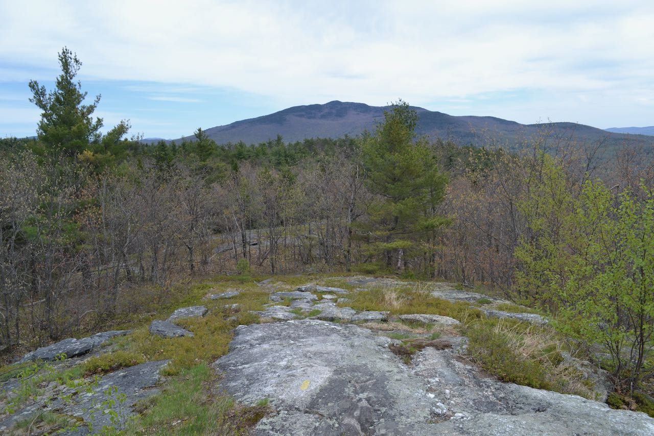
At the southern tip of a mammoth ridge guiding the terrain from the Baker River Valley to the heights of Carr Mountain, the crags of Rattlesnake Mountain are an eye-catching feature from the highway below. The mountain, although it's little more than the top of the cliffs, is one of the more familiar sites in this less-traveled region of the White Mountains. Even more of a draw than its hiking appeal is its popularity with mild thrill seekers of the rock climbing variety. While the hiking trail is served by an inconvenient pull-out on an incline with space for barely a few cars, the rock climbers can start from two recently rennoved generous parking lots due to its burgeoning popularity. The summit ledges are set back from the major rock climbing inclines, though, so the two classes of visitors will be in separate worlds. From the relaxing perch on the rocks, you have a pastoral birds-eye view of the valley and town of Rumney, with plenty of big mountain scenery all around. The view is among the best to be found from peaks of this low elevation. The distance to the top of this minor summit is not overwhelming, but it does involve some stiff climbing that will take just a bit of time.
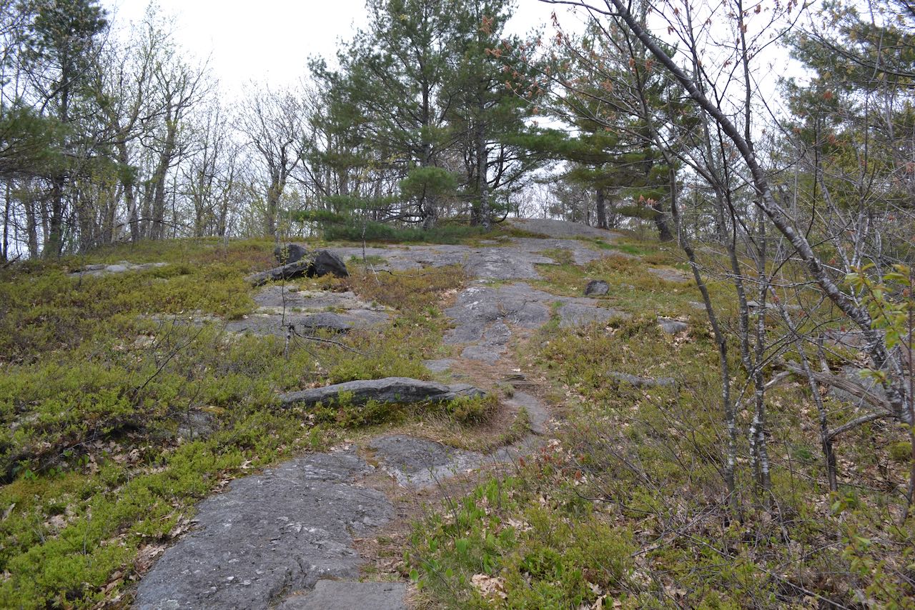
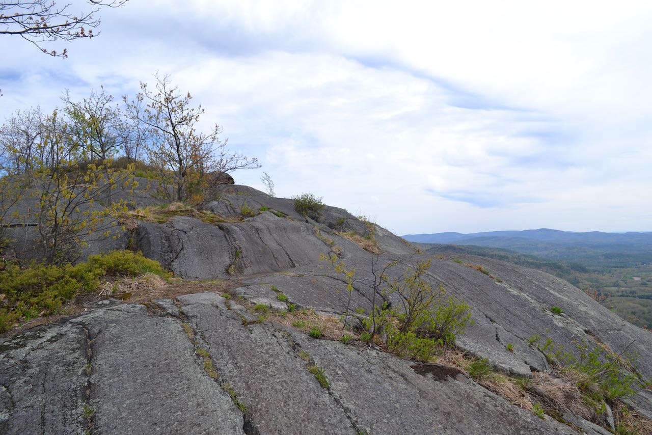
The Rattlesnake Mountain Trail starts into the woods near a brook that drains from the slopes of Upper Rattlesnake Mountain, the next minor summit up the ridge toward Carr. It directs away from the brook and paces into the woods under a canopy of sturdy pine trees, soon passing by a less-used connector path on the right coming from the other potential parking. After 0.2 miles over gentle terrain, the trail swings left and joins a tributary of the brook and begins climbing steadily over roots and rocks. The trail crosses a couple small brooks and turns right after 0.1 miles, pointing straight uphill. A rigorous ascent commences on a bulky footway. Some rocks underfoot may be loose; take time on this section, which is the major part of the hike. It lasts a half mile in total; as you approach the end of this section, the terrain levels off and transitions into a plateau. A trail junction is reached, where the loop portion of the hike begins. Turn right for the best scenery experience climbing up onto the ledges. The trail encounters ledges and wanders up over them amidst low bushes. It reaches the base of the summit opening in 0.3 miles, where it turns left and climbs up along the edge of the airy open rock. Intrepid explorers can find a bonus viewpoint that looks further to the west by turning right before this. As you climb up toward the highest point, sweeping views open over the valley.
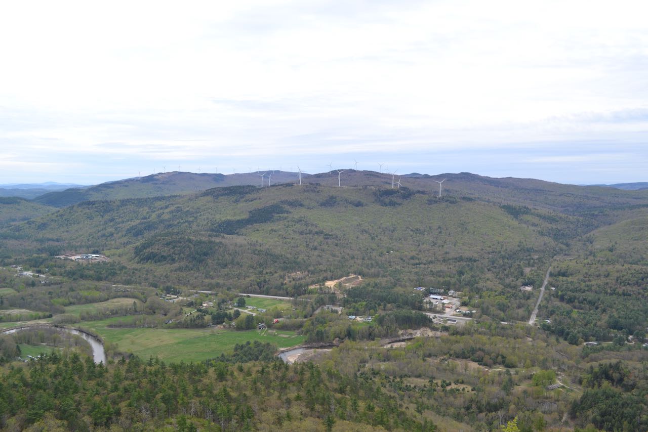
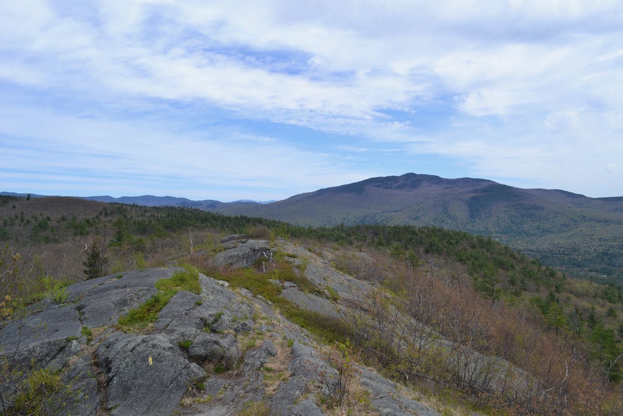
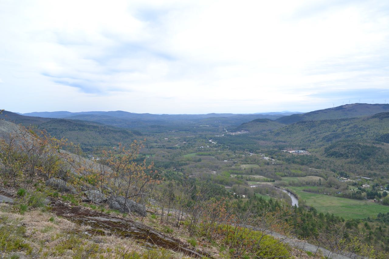
Across the way are the modest-sized mountains which house an extensive wind farm, the tallest being Tenney Mountain. A geometric four-way in the roads points into the Groton Hollow, a passage through the mountains. Further to the right, recognizeable Mt. Cardigan rises in the distance over the landscape around some of its spur mountains. Down below the wind towers, the graceful Baker River weaves through the fields and open spaces in Rumney Village. The streets and houses fade into the distance as the view extends out the valley, with a number of hills in the distance, including the Belknap Range furthest out on the right side. Bits and pieces of the Ossipee and Squam Ranges can be seen to the left, appearing as broad, rolling hills. As you continue around the corner toward the top, Stinson Mountain comes into view, just on the other side of town. To its left, looking right over the trail, a few distant summits can be seen which include Mt. Hancock and Scar Ridge. Multiple peaks of Mt. Kineo trail off to the left. Furthest over, of course, you can see the ridgeline continue up towards Carr Mountain. The best views are seen before you cross over the top; then the trail continues out in the open for a way, then dips down into the woods. It runs over more ledge ramps, then in 0.2 miles hops up over a knob with the last view of the trip. Descend 0.1 miles to the base of the summit cone and turn left, passing the loop junction, and return down the way you came.
Printable directions page